|
(Nieuwe pagina aangemaakt met '{{Context VN |Model link=Bfn Data analysis foreshore rubble }} {{Context VN show}}')
|
|
||
| Regel 1: | Regel 1: | ||
| + | |||
{{Context VN |
{{Context VN |
||
|Model link=Bfn Data analysis foreshore rubble |
|Model link=Bfn Data analysis foreshore rubble |
||
}} |
}} |
||
{{Context VN show}} |
{{Context VN show}} |
||
Huidige versie van 24 okt 2017 om 15:39

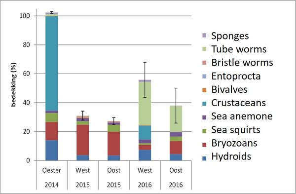
Average percentage of coverage for the epifauna at 2014, 2015 and 2016 Tangelder et al (2017).

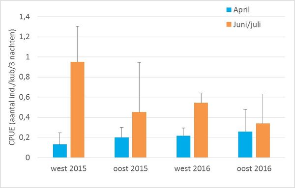
The CPUE of the west and east (oost) part of the study area. The error bars show the standard deviation the three measurement days. Tangelder et al (2017).

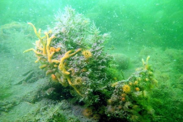
Picture of oyster reef (-5m NAP) at the study location, T0-measuremetn (Photo: Marco Dubbeldam, Stichting Zeeschelp, August 2014)
Referenties
- Ontwikkeling epifauna, infauna en kreeften (T0, T1, T2) op een ecologisch aantrekkelijke vooroeverbestorting (Schelphoek, Oosterschelde), Tangelder, M., T. van Oijen, M. de Kluijver en T. Ysebaert, IMARES Wageningen UR, 20 juni 2017.
Zie ook
- Foreshore rubble
- Data collection and data analysis
- Data analysis mastic asphalt
- Conclusions foreshore rubble
- Data analysis ecoblock revetments
- Ecosystem functions of foreshore rubble
- Physical properties of foreshore rubble
- Ecosystem services of foreshore rubble
- Design foreshore rubble with stakeholders
- Literature review and interviews foreshore rubble


