| Bfn Data analysis foreshore rubble | |
|---|---|
| Context | Bfn Building for Nature project |
| Decompositie type | IOR |

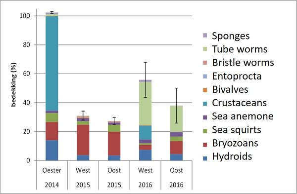
Average percentage of coverage for the epifauna at 2014, 2015 and 2016 Tangelder et al (2017).

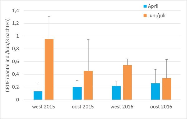
The CPUE of the west and east (oost) part of the study area. The error bars show the standard deviation the three measurement days. Tangelder et al (2017).

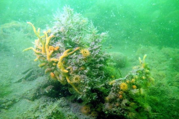
Picture of oyster reef (-5m NAP) at the study location, T0-measuremetn (Photo: Marco Dubbeldam, Stichting Zeeschelp, August 2014)
De View-Navigation (VN) pagina's.
De links naar andere pagina's.
| Produceert | Bfn Conclusions foreshore rubble |
|---|---|
| Consumeeert | Bfn Data foreshore rubble |
| Onderdeel van | Bfn Desiging and researching ecological potential foreshore rubble |
| Instantie van | |
| Betreft |
De pagina's die linken naar deze pagina.
Dit element heeft geen subelementen.
| Komt van | Type | Connectie type | Conditie | Waarde | Opmerkingen |
|---|---|---|---|---|---|
| Bfn Design foreshore rubble with stakeholders | Connects | seq |


