| RA Intrusion of salt water | |
|---|---|
| Context | RA Rammegors |
| Decompositie type | IOR |

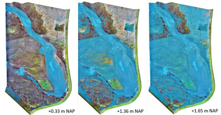
Since 7 December 2016, the Rammegors is influenced by tides due to an inlet in the Krabbenkreekdam. This inlet was already opened twice. First, at 5 December 2014 and closed again at 19 December 2014, as there was too much erosion. A second time, from 18 February 2015 till 22 April 2015 the dam broke and was therefore closed. During high tide, a larger area is inundated and a larger water column is present in the gully. The average low and high tide in the Rammegors are 0.33 and 1.36 meter. The left and middle images in Figure 1 show the average low and high tide situation in Rammegors, respectively. The rightest image shows the situation during extreme conditions when the safety measurements have taken place (Van de Lageweg et al. 2019.
De View-Navigation (VN) pagina's.
De links naar andere pagina's.
| Produceert | |
|---|---|
| Consumeeert | |
| Onderdeel van | RA Bringing tide back in Rammegors |
| Instantie van | |
| Betreft |
Draagt bij aan.
| Draagt bij aan | RA Groundwater quality |
|---|---|
| Waarde | + |
| Opmerkingen |
De pagina's die linken naar deze pagina.
Dit element heeft geen subelementen. Naar dit element wordt niet geconnecteerd.


